
Agrian Mobile
Our FREE app gives you the power to:
- Search for products within our database of over 12,000 indemnified labels
- View the product label with a simple click
- Access manufacturer labels, Safety Data Sheets, and other product documentation
- Search for and share your recommendations, use reports and other record types
- Save and organise products and records for access offline
- And much more!


Agrian NextGen Mobile
We go where you go.
Subscribers have access to enhanced capabilities in the palm of their hand.
In today’s fast-paced world, you must always have access to the information you need to make real-time decisions – and that comes down to having the right tools.
For more details on how to get started with Agrian NextGen Mobile please email your client success rep at cs@agrian.com or sales@agrian.com.
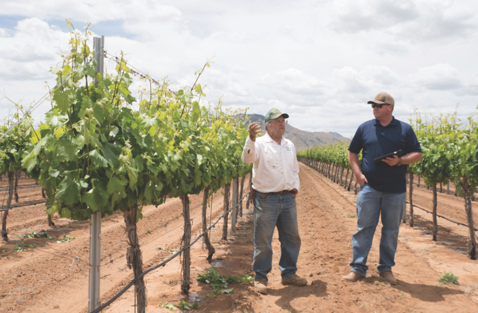
Field inspection & trapping
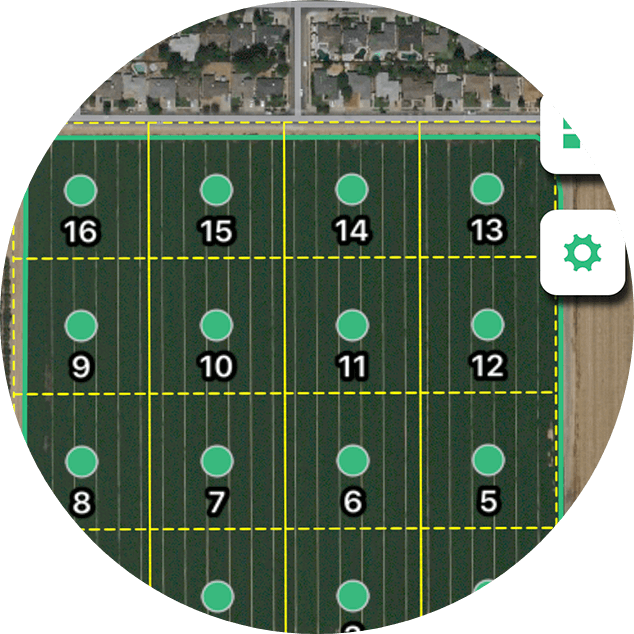
Have an inspection observation? Enter it, the count you observe, the percentage of the crop affected, degree of severity, any actions required, other notes you want to record, or even upload photos. All of this appears under easy-to-read icons on your dashboard, available for you, your customer and other trusted team members.
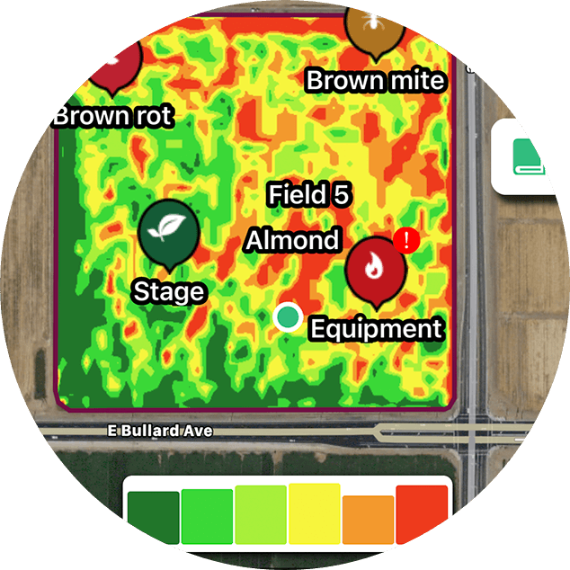
Imagery
Agrian provides imagery so that you have a view from above and the years prior available at your fingertips. Images can be used to create targeted inspections, as well as management zones and target events.
Soil & tissue sampling
Take soil, tissue and nematode samples seamlessly using your easy-to-follow dashboard, which is linked by GPS to the field. On the map, simply drop points where samples have been taken from and enter details such as column depth and what you want to test for. Call up the grid on your iPad in the field, and reference corresponding labels for the lab.
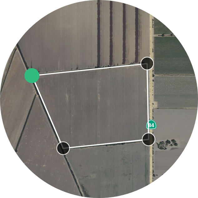
Create, map and manage
Create and map on the go with our mapping tool. Have a field you need to inspect but don’t have time to head back to the office? Map the field and start inspecting immediately. Map by dropping points or by GPS.
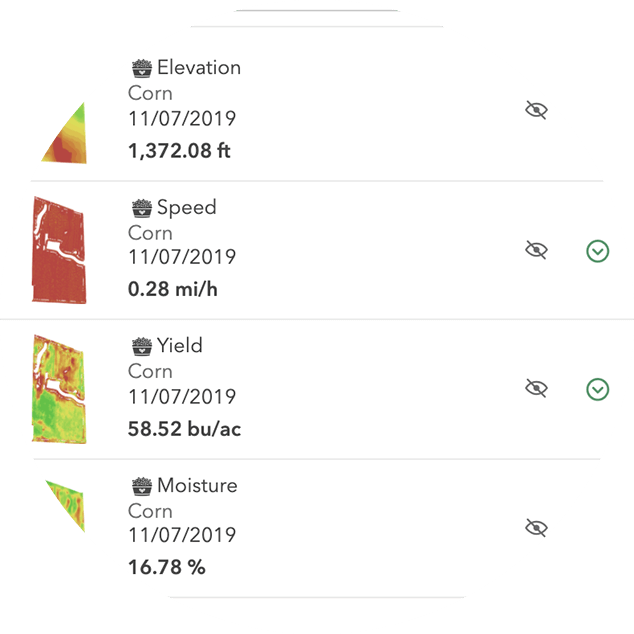
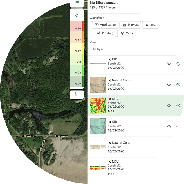
View layers
View satellite imagery and field events including planting, harvest, pesticide application and Veris data. Layer over your field as a guidance layer during inspection.

Upload agronomic machine data
Take all your raw planting, pesticide application and harvest data straight from the machine into the Agrian platform, where it is turned into easy-to-read actionable insight.
To get started please email your client success rep at cs@agrian.com or sales@agrian.com.
Phone Support
Questions?
Get in touch with Support
Monday – Friday
6.00 am to 5.30 pm Pacific Time
Saturday
8.00 am to 12.00 pm Pacific Time